
2026 Sky’s The Limit Hiking and Walking Challenge
Step into history, stretch your legs, and see Connecticut in a whole new way.
The 2026 Sky’s the Limit Hiking and Walking Challenge invites you to explore some of Connecticut's State Parks and Forests, each with a story to tell. This year’s theme, “America’s 250th", celebrates Connecticut’s role in shaping our nation - from Revolutionary War landmarks to places that reflect the voices and experiences of diverse communities across time. This year’s challenge starts with 20 different hikes, but we are keeping some of our powder dry, so be on the lookout for additional missions to be launched as the year progresses.
Whether you're hiking solo, adventuring with a flock of friends and family, or bringing along your leashed four-legged companion, this challenge is your chance to learn, explore, and play outdoors.
Using the Goosechase app, you’ll complete fun, interactive missions - checking in at designated locations, snapping photos, answering trivia, and discovering hidden gems along the way.
Ready to get started? Download the app, enter the join code, and let the adventure begin!
Continue scrolling for all the important details.
How It Works
- Download the Goosechase app from your mobile app store (free on iOS and Android)
- Enter the game code ZMUCP8
- Browse the available missions across Connecticut
- Choose which location to visit first: then check in, complete missions, and submit your answers through the app
- Earn points and track your progress on the leaderboard
Challenge Rules & Guidelines
- Explore at Your Own Pace
This is a self-guided challenge - complete missions anytime between April 16, 2026 and Friday December 4, 2026 at 5 pm. There's no need to finish everything in one trip! - Complete Missions to Earn Points
Each location includes one or more missions, which may involve:
Taking and uploading photos,
Answering trivia questions,
Checking in at specific locations, and
Follow the instructions in the app carefully - creativity is encouraged! - One Account Per Participant
Each participant is allowed only one Goosechase account to participate in the challenge and cannot create multiple accounts. If participating as a family, individuals can use one shared account, provided all members are in attendance and using the same device. Only one prize will be awarded per account, if eligible. - Play Fair
All submissions must be your own and completed at the designated locations. No duplicate, reused, or misleading submissions, please - this is an honor-based challenge. - Stay Safe & Respect the Parks
Follow all posted park rules and hours,
Stay on marked trails,
Be mindful of weather and terrain,
Carry water and wear appropriate footwear, and
Leave no trace - take only photos, leave only footprints. - Pets are Welcome (Where Allowed)
Leashed pets are welcome in many locations - please follow park-specific pet policies. - Have Fun with It!
Get creative with your photos, learn something new, and enjoy the journey. This challenge is about exploration, discovery, and connection - not just competition.
Earning Points
Climb the Leaderboard
As you complete missions in Goosechase, you’ll earn points and move up the live leaderboard, where you can see how you stack up against fellow explorers across the state.
While this is first and foremost a hiking and walking challenge, don’t be surprised if the history buffs start climbing the ranks too - those trivia points can add up quickly!
Choose Your Adventure
Not all paths are created equal…
- Some missions will unlock new opportunities as you earn more points
- Additional missions may be released throughout the year
- At certain locations, the trail (or hike) you choose may lead to different missions and bonus challenges
Plan your journey wisely - your route could shape your score!
How Many Points Can You Earn?
How many missions will there be?
How many points can you collect?
The Sky’s the Limit!
New missions will be added throughout the challenge, and can unlock subsequent missions.
Prizes & Drawing
At the end of the challenge:
- The top 100 participants on the live leaderboard will be entered into a random drawing
- Winners will receive limited-edition Sky’s the Limit hiking sticks and other fun prizes
What Does It Mean to 'Complete' the Challenge?
Completion looks different for everyone:
- Visit as many of the designated locations as you can
- Complete missions, learn something new, and enjoy the journey
- Whether you reach the top of the leaderboard or just check off a few parks, you’re part of the adventure
Tips for Success
- Check mission details before heading out
- Check in promptly upon arrival to unlock subsequent missions
- Enable location services for the best app experience
- Make sure your photos are clear and match the prompt
- Follow @CTStateParks for updates, highlights, and trivia answers
About the Theme - A Celebration 250 Years in the Making
The 2026 Sky's the Limit ("STL") Challenge theme - A Celebration of America's 250th - aligns with celebrations occurring across the country to commemorate the 250th anniversary of the signing of the Declaration of Independence while highlighting our state parks and forests with historical significance.
In order to celebrate 2026 and America's 250th (it's not often one can say we are celebrating a semiquincentennial), State Parks is excited to be moving the challenge into the digital ages, hosted on the Goosechase App. The Connecticut State Parks and Public Outreach Division is thankful for a STIHL grant from the Hearts of STIHL program that provided the funding for us to host this year's challenge on the Goosechase app.
Connecticut State Parks was established in 1913, but many of our parks and forests contained rich history prior to their incorporation into the Connecticut State Parks system. The locations designated for this year's challenge were selected for their historical significance or ties to the development of our nation into what it is today. To learn more about the celebration of America's 250th within Connecticut including upcoming events and ways to get involved, please visit the America 250 CT Commission webpage.
Please also be sure to visit the CT Parks Calendar of Events page for activities, events and programs being offered within our CT State Parks and Forests throughout the year.
Locations
Where will the 2026 Sky's the Limit Challenge take you this year? Below is a list of all 20 designated locations. Full mission details for each location are included on the Goosechase App.
- Beckley Furnace Industrial Monument, North Canaan, CT
- Bluff Point State Park, Groton, CT
- Civilian Conservation Corps (CCC) Museum at Shenipsit State Forest, Stafford/Somers/Ellington, CT
- Collis P. Huntington State Park, Redding, CT
- Dennis Hill State Park, Norfolk, CT
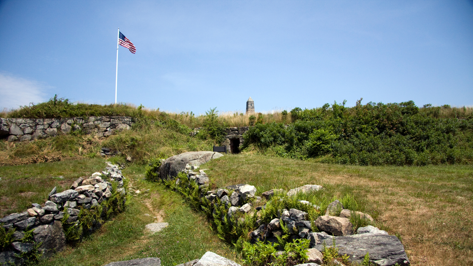
- Fort Griswold Battlefield State Park, Groton, CT
- Fort Trumbull State Park, New London, CT
- Gillette Castle State Park, East Haddam/Lyme, CT
- Hammonasset Beach State Park, Madison, CT
- Heublein Tower at Talcott Mountain State Park, Simsbury/Bloomfield/Avon, CT
- Hurd State Park, East Hampton, CT
- James L. Goodwin State Forest, Hampton, CT
- Lovers Leap State Park, New Milford, CT
- Mount Tom State Park, Washington/Litchfield/Morris, CT
- Osborne Homestead Museum, Osbornedale State Park, Derby, CT
- Peoples State Forest Nature Museum, Barkhamsted, CT
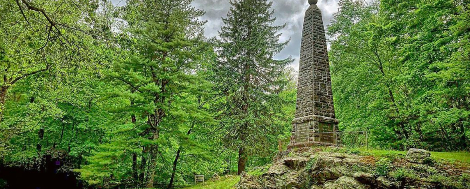
- Putnam Memorial State Park, Redding, CT
- Sherwood Island State Park, Westport, CT
- Sleeping Giant State Park, Hamden, CT
- Windsor Locks Canal State Park, Windsor, CT
History of the Challenge
Sky's the Limit is a self-guided challenge inspiring residents to explore Connecticut's treasured state parks and forests. Each year, a curated list of approximately 20 locations is announced, and participants are encouraged to visit as many of those locations as desired and explore the trails and sights within them. Our small state boasts 142 state parks and forests, and most participants use the challenge as an opportunity to visit new destinations and are thrilled to discover newly beloved locations in the process.
Each year. the challenge begins in the spring, and participants have until the first Friday in December to complete the challenge. All who participate will receive a downloadable Sky's the Limit certificate acknowledging their efforts. Fun prizes like stickers may be awarded to participants during the Challenge. In addition, at the end of the Challenge, the top 100 people on the leader board will have the chance to win a hand-carved Sky's the Limit hiking stick (will be based on points earned on the app's leaderboard). The hand-carved hiking sticks are created from wood sourced in Connecticut by staff at DEEP's sawmill in Portland, CT and members of the Connecticut Woodcarver's Association.
The challenge is open to anyone and everyone who wants to participate and learn more while exploring Connecticut's parks and forests by hiking and walking. Whether you are a solo hiker or walker, or you prefer company with family, friends or even a four-legged leashed companion, this challenge is for you!
Questions? We're Here to Help!
Please contact us at deep.skysthelimit@ct.gov with your questions, comments and concerns. Please include your name and a contact number if you would like us to contact you.