2024 Sky’s The Limit Hiking Challenge
Ready for an outdoor hiking adventure? Go on your own, grab a friend or family member, or bring your leashed four-legged companion along for the 2024 Sky’s The Limit Hiking Challenge (STL). If so, join the Connecticut Department of Energy and Environmental Protection’s (DEEP) State Parks and Public Outreach Division as they “Ring In” the first week of Spring on Friday March 22, 2024, with the release of the 2024 Sky’s The Limit Hiking Challenge (“STL”).
Take the challenge to get outside for some fresh air and physical exercise. Hike and walk the highlighted locations/trails and take designated photos along the way to experience this year’s STL theme, “CT State Forests”. Fifteen (15) State Forest locations will be identified for participants to explore, with varying scenery and highlights at each location.
Did you know that there are 33 State Forests in CT, and it is estimated that the forest covers between 57% and 60% of the land area in the State. Join this years’ STL Hiking Challenge and visit approximately half of the State Forests in CT. Participants who hike or walk 10 of the 15 forest trails will receive a 2024 “Sky’s the Limit” hiking staff medallion and a certificate for their efforts. For hiking or walking all fifteen (15) locations, in addition to the medallion and certificate, 50 participants will have a chance to receive a hand-carved hiking staff made by the CT DEEP Sawyer from the DEEP Sawmill or from the CT Woodcarver's Association.
On January 1, 2025 (or another date if determined) names will be drawn from those who visited all fifteen (15) locations, and 50 winners will receive a hand-carved hiking staff made by our DEEP Sawyer who works at our CT DEEP Sawmill or by the CT Woodcarvers Association.
All entries are due by 3 pm on Friday, December 6, 2024.
Please submit your 2024 STL Hiking Challenge information through the Google Form.
If you post your photos on social media, please use the #CTSTL2024 or #CTStateParks.
PLEASE SAVE THE DATE: On Wednesday January 1, 2025 between 11am and 1 pm, we will be celebrating the 2024 STL Hiking Challenge Program with a celebration/First Day Event at Sessions Woods Wildlife Management Area in Burlington, CT. At this program/event STL 2024 medallions and certificates will be handed out. There will also be a live drawing for hiking sticks (all those that completed all 15 hikes will have their names entered into a drawing for a chance to win a hand-carved hiking stick.) If you are unable to attend the event, we will make arrangements for you to pick up your certificate and medallion at another time or it will be mailed out. Please be aware that dogs on a leash are welcome to join for the outdoor portion of the event. However, dogs are not allowed inside of the Sessions Woods-Education Center. PLEASE NOTE THAT THIS EVENT IS FOR STL PARTICIPANTS AND THEIR FAMILIES.

Hike or walk the listed trails within the 15 CT State Forests.
Please be aware that the number of miles included in the write-ups below are suggested for participants to hike or walk. Please Note: Participants can shorten or lengthen their hike or walk they take at their discretion.
Snap a photo.
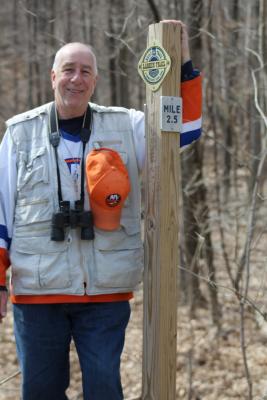
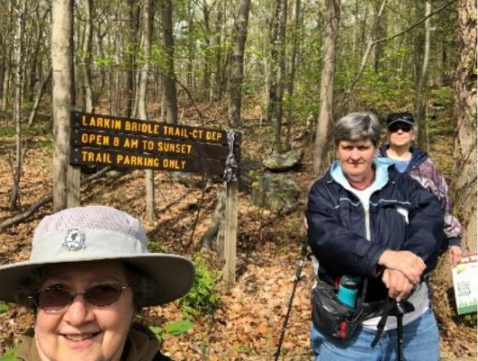
Snap a photo of yourself (and your dog if he/she joins you) by a designated State Forest sign (this could be a shield sign, other signage or a kiosk with the name of the state forest, or a trail sign identifying the location).
Take additional photos of yourself.
Take additional photos of yourself (and your dog if he/she joins you) at the location(s) described in the specific write-up(s) below. Please note: Many locations will require several photos be taken.
Submit your entry.
Please be aware that your Sky's the Limit (STL) 2024 submittal can now be completed/sent using the 2024 STL Hiking Challenge Google Form. To use this form, a person may be required to sign-in to Google or set-up a Google account. By using the Google Form, no other document or email needs to be submitted.
Entries must be received by 3 pm on Friday, December 6, 2024.
Please note: If participants are unable to use the Google form or have specific questions, please contact DEEP.SkystheLimit@ct.gov for assistance. When providing attachments (photo or document) please do not send links to external sources (Facebook, etc.). We often have a difficult time accessing external sources. Please be sure to include the following information: name, address, email, phone number, and signed photo release Photo Release Form (each STL hiking participant shall submit a signed Photo Release). This form can be printed out, filled out and then a photo of the form can be taken and sent in with your submission. Entries must be received by 3 pm on Friday, December 6, 2024.
Be aware.
To be entered to win a hiking staff (live drawing on January 1, 2025 or another date, if determined) all entries (must include the completion of all 15 hiking/walking locations) must be received by 3 pm on Friday, December 6, 2024 to be entered into the drawing.
The majority of the State Forest maps attached below take you to DEEP maps (some of which are Geo referenced PDF Maps). There are other non-DEEP map references as well, for example, explorect.org, ctvisit.com, AllTrails maps, Google Maps, CT Trail Finder.
Please check out the additional information section as well as the DEEP website included in each write-up below for suggestions of other hikes on-site as well as other things to do like (letterboxing) while at the various State Forest locations below.
Feel free to visit the following for more information regarding CT Forestry: CT Forestry Division; Mission of the Forestry Division; Forestry Division Programs; and Urban Forestry in CT.
Since many of our STL participants hike with their canine friends, we will have a special give-away for the dogs again this year. Please read the following if hiking with a canine friend: The majority of Connecticut State Parks and Forests allow dogs, but according to state regulations the dogs must be on a leash no longer than 7-feet and under the control of the owner or keeper at all times. Pets on a leash are permitted in most state parks and forests, but not allowed in buildings, swimming areas, or state park campgrounds. Please be sure to remove and properly dispose of pet waste. Check individual park/forest pages for more specific information.
Before heading out onto the trails with your dog, be sure to review “Related Information” on each individual forest webpage on the DEEP website or CT Parks website to read the rules for pets and also visit the Responsible Recreation section of the DEEP website.
STL 2024 Google Map or CT Trail Finder Map of Hiking Locations (to be added second week of April)
Pootatuck State Forest
Information:
Pootatuck State Forest (Squantz Pond State Park) is in New Fairfield, CT
Trail Name(s): Participants choose one trail
Option 1 is the CCC/Forest Road - take white/grey trail (forest/CCC road) starting off of Pine Hill Road following it to Short Wood Road (green gate CCC road entrance) and then turn around and head back. This distance is approximately (6) six miles round trip
OR
Option 2 is the CCC/Forest Road/Orange/Yellow and Blue Trails - take white/grey trail (forest/CCC road) starting off of Pine Hill Road following it to Short Wood Road (green gate CCC road entrance) and then turn around and head back. This distance is approximately (6) six miles round trip
Approximate Length of Hike/Walk:
Option 1 is approximately 6 miles round-trip. Option 2 is approximately 2.8 miles roundtrip. See information above.
Maps:
Squantz Pond SF Map
Pootatuck State Forest Loop
Pootatuck State Forest Map
Overview/History:
The forest was named after the Pootatuck Native American tribe, who originally inhabited the region. They were part of the Algonquian-speaking Pequot tribe and lived along the banks of the Housatonic River, which borders the state forest. The land that is now Pootatuck State Forest was acquired by the state over several years, starting in the 1920s. The primary purpose of acquiring this land was to protect the watershed of the Housatonic River, as well as conserve the area's natural resources and wildlife.
Pootatuck State Forest is almost 1,200 acres. It is located primarily in New Fairfield, with a small portion in Sherman. The main block of the Forest rises steeply from the western shore of Squantz Pond. Most of the Forest was acquired in the 1920s for about $10 per acre. In the 1930s, the Civilian Conservation Corps (CCC) established a work camp at nearby Squantz Pond State Park. The CCC was very active in the Forest. They planted trees, built roads and fire ponds, salvaged dying chestnut trees for posts and poles, and did forest thinning to produce firewood.
Parking Area(s):
Park off of Pine Hill Road (Parking Area) in New Fairfield
Degree of Difficulty:
Option 1 is considered moderate to difficult. Please note that areas of the main road are washed out. The width of this specific road is wide enough to hike/walk. Based on site conditions/weather conditions, the road can be a little rough in some areas. Option 2 is considered more scenic and easier to moderate, family friendly.
Photo Locations:
Photo of the signage/kiosk; photograph looking out at the Rock Lookout; and a photo of the participants choosing from along the trail.
Additional Information:
If planning to visit Squantz Pond before or after your hike/walk, PLEASE NOTE that parking at Squantz Pond is limited to 250 vehicles. Once capacity is reached, the park is closed, and will remain closed for the rest of the day. Walk-ins are Prohibited. Please be aware that there is no alternative parking or unloading on local roads and parking lots/vehicles will be ticketed and/or towed.
Visit the “While You are Here” section of the Squantz Pond Website (scroll to the bottom of the page) to find other things to do before or after your hike/walk.
Nipmuck State Forest
Information:
Nipmuck State Forest (Bigelow Hollow State Park) is in Union, CT
Trail Name(s):
Blue Trail (Nipmuck Trail) to the Blue/Red Dot BRD (Breakneck Pond View Trail). Hikers can then go back the same route and return to the parking area.
Approximate Length of Hike/Walk:
The approximately length of the hike/walk round-trip is 7.4 miles.
Map:
Bigelow Hollow State Park Map
Overview/History:
Nipmuck State Forest and the adjoining Bigelow Hollow State Park offer over 9,000 acres of recreation opportunities including miles of hiking trails, and an 18-acre pond in Eastern Connecticut.
Nipmuck State Forest and Bigelow Hollow State Park in the town of Union lie within one of the largest unbroken forest areas in Eastern Connecticut. Nipmuck is the second oldest state forest in Connecticut. The first parcel was acquired in 1905. Additional lands in the towns of Stafford, Ashford, Willington, and Woodstock have been added to the forest over the years. Today Nipmuck State Forest and Bigelow Hollow total over 9,000 acres. The recreation area in Bigelow Hollow was established in 1949 by the State Park and Forest Commission.
The name "Bigelow" is a mystery since no person of that name seems to have been associated with this area. According to older residents of Union, the name is derived from "Big Low" in reference to the deep hollow in which the 18-acre pond of that name is located. The word "Mashapaug" is the Nipmuck Indian word for "Great Pond". The present lake of 300 acres was originally about half the size. In the mid-1880's, two different parties attempted to draw the water from this natural pond. One party ditched to the north and the other to the south. The latter party was forced to give up the battle when they ran into a ledge and later joined forces with their rivals to create the present lake. Two other smaller ponds, Breakneck and Griggs, lie to the north and east of Mashapaug in Nipmuck State Forest.
The contrast of rock, water, and mixed deciduous/evergreen woodland provide ample beauty to the many visitors this park receives.
Parking Area(s):
Located to the right upon entering the Park Entrance.
Degree of Difficulty:
Moderate to Difficult due to length. Please note that wet conditions can affect the trail.
Photo Locations:
Photo of the signage/kiosk; photo of Breakneck Pond; photo of the waterbody, and photo of the participants choosing from along the trail.
Additional Information:
Visit the “While You are Here” section of the Bigelow Hollow State Park page (scroll to the bottom of the page) to find other things to do before or after your hike/walk.
Shenipsit State Forest
Information:
Shenipsit State Forest is in Stafford, Summers and Ellington, CT
Trail Name(s):
Blue-Blazed Shenipsit Trail (starting from the parking area off of Gulf Road) to the Blue-Green Trail to the Blue-Blazed Trail to Webster Road and then head back (pass over Soapstone Mountain and tower)
Approximate Length of Hike/Walk:
Approximately 1 mile to Soapstone Mountain (tower) and back or approximately 3.3 miles following the Blue-Blazed and Blue-Green Trails between Gulf Road and Webster Road
In, Under, Over or Through Hike/Walk:
Participants hike/walk the Green Trail and the Red Trail
Maps:
Shenipsit State Forest Map
Overview/History:
The Forest contains 11 parcels spread over 7,000 acres in northeastern Connecticut. The two primary attractions are the wonderful hiking along the Blue-Blazed Shenipsit Trail which passes over Soapstone Mountain and the amazing views from the Soapstone Mountain observation tower. While the original fire tower is long gone, today’s tower stands specifically for the public’s recreational viewing. As one of only two observation towers in Eastern Connecticut (the other being the monument at Fort Griswold State Park in Groton), the vistas afforded from this vantage point are spectacular as visitors can take in scenes from the Connecticut River Valley to the Springfield skyline.
Shenipsit State Forest began in 1927 with the purchase of land at the summit of Soapstone Mountain in Somers to erect a fire tower to keep a lookout over the forests of the eastern woodlands. Over time, additional acreage was purchased to form the sprawling 7,078 acres state forest we have today in Ellington, Somers and Stafford.
Shenipsit is dominated by nearly pure stands of oak, particularly red oak, as a result of repeated clear-cutting for charcoal production and as a result of fire. All of this occurred prior to State ownership. Oak reproduction favors the open, full-sunlight conditions created by clear-cutting and by fire. Additionally oak seedlings and saplings almost always re-sprout from the root collar and grow vigorously after the above-ground part of the tree has been killed. Oak trees produce valuable timber as well as important wildlife food – acorns are an important source of nutrition for deer, turkey, squirrels and other wildlife.
There is an abundance of recreational opportunities at Shenipsit State Forest. The two primary attractions are the wonderful hiking along the Blue-Blazed Shenipsit Trail which passes over Soapstone Mountain and the amazing views from the Soapstone Mountain observation tower. While the original fire tower is long gone, today’s tower stands specifically for the public’s recreational viewing. As one of only two observation towers in Eastern Connecticut (the other being the monument at Fort Griswold State Park in Groton), the vistas afforded from this vantage point are spectacular as visitors can take in scenes from the Connecticut River Valley to the Springfield skyline.
Civilian Conservation Corps (CCC) History
Shenipsit is also home to Connecticut’s museum of the Civilian Conservation Corps (CCC). The CCC was President Franklin D. Roosevelt’s solution to the need for environmental conservation work and the large number of unemployed young men during the Great Depression until 1941, our entry into World War II. The "CCC Boys", mostly ages 17 to 24, lived in military style camps and were paid $1 a day to work in what are now the state and national forest and park systems.
In 1935 CCC Camp Conner was established at the present site of the Shenipsit Forest Headquarters and CCC Museum. The Museum is located in the only remaining CCC barracks building in the State and pays homage to the dedicated men who worked in Connecticut camps. The museum features a large collection of tools, equipment, photographs, and memorabilia from the former "Camp Conner" and 21 other camps in the State.
In Connecticut camps the "CCC Boys" were responsible for the creation and maintenance of many of our state parks and forests including: Hammonasset Beach, Chatfield Hollow, Squantz Pond, and Southford Falls; Pachaug, Cockaponset, and many more state forests. They constructed buildings, forest roads, and recreation areas, planted trees, and fought forest fires in every state in the United States. A short descriptive and pictorial tour guide to the CCC Museum is available for viewing or download as a PDF document.
Parking Area(s):
Parking lot off of Gulf Road
Degree of Difficulty:
Easy to moderate due to length being hiked or walked.
Photo Locations:
Photo of signage/kiosk; photo from the observation tower; photo from along the trail.
Additional Information:
Be sure to plan your hike/walk so that you are able to visit the CCC Museum when done. Museum entrance is on Route 190, 1 mile east of Gulf Road. Visit the “While You are Here” section of the Shenipsit State Forest page (scroll to the bottom of the page) to find other things to do before or after your hike/walk.
The two primary attractions at this location of the hiking along the Blue-Blazed Shenipsit Trail which passes over Soapstone Mountain and the views from the Soapstone Mountain observation tower. While the original fire tower is long gone, today’s tower stands specifically for the public’s recreational viewing. As one of only two observation towers in Eastern Connecticut (the other being the monument at Fort Griswold State Park in Groton), the vistas afforded from this vantage point are spectacular as visitors can take in scenes from the Connecticut River Valley to the Springfield skyline.
Peoples State Forest
Information:
Peoples State Forest is in Barkhamsted, CT
Trail Name(s):
Elliott Bronson Trail to the Walt Landgraf Trail (Red Blaze) Starting in the lot near Matthies Grove, this trail runs through the southern portion of the forest crossing a 60-foot cliff; takes a rugged climb over Ragged Mountain; then leads to an area of rock ledges known as the Indian Caves.
Approximate Length of Hike/Walk:
3.2-mile loop over Ragged Mountain and to the Indian Caves
Maps:
Peoples State Forest Map
Overview/History:
Peoples State Forest is located in the Pleasant Valley section of Barkhamsted. Other attractions at this location include the 200-year-old white pine picnic groves in the Matthies Grove and Whittemore Recreation Areas, over 11 miles of hiking trails, the Barkhamsted Lighthouse, and other cultural and historic sites.
Peoples State Forest’s rugged terrain, dense forest, stunning waterfalls, and pristine river offers some of the state’s finest fishing, hunting, and winter sporting activities. The West Branch of the Farmington River, designated as a Wild and Scenic River by the National Park Service, is the center point of the park’s world-class, river-based recreational activities including trout fishing, canoeing, kayaking, and tubing.
Did you know that Peoples State Forest is literally the people’s forest? The Connecticut Forest and Park Association coordinated a subscription program that allowed groups like the Daughters of the American Revolution and the Connecticut Federation of Women's Clubs and countless individuals to purchase land for roughly $8 an acre to donate to the people of Connecticut. The forest was established in 1924.
Parking Area(s):
Park in the lot by Mattheis Grove
Degree of Difficulty:
Moderate to difficult due to elevation and rocks
Photo Locations:
Photo of sign/signage/kiosk; feature along the trail (Indian Caves); photo of the participants choosing from along the trail.
Additional Information:
Be sure to plan your hike/walk so that you are able to visit the Nature Museum on-site when you are done. This Museum is typically open Friday through Monday, Memorial Day weekend through Labor Day Weekend.
Visit the “While You are Here” section of the Peoples State Forest page (scroll to the bottom of the page) to find other things to do before or after your hike/walk.
Cockaponset State Forest
Information:
Cockaponset State Forest in is the Pattaconk Lake Area in Chester and Haddam, CT
Trail Name(s):
Cockaponset Blue Trail (starting off of Rte. 148)
Approximate Length of Hike/Walk:
Approximately 1.5 miles (or 3 miles out and back) starting at Route 148 and following the Blue Trail to the parking lot (near the yellow trail and the former Filley Road).
Maps:
Cockaponset (Southern Section Map)
Overview/History:
Connecticut’s second largest state forest, Cockaponset, spans over 17,000 acres with parcels of protected land scattered across two counties and eleven towns. With more than 100 miles of hiking trails, pristine Pattaconk lake, overlooks, streams, and a range of terrain; the park is popular for swimming, hiking, mountain biking, horseback riding, kayaking, and just getting outside.
Cockaponset, named after an Indian chief, who's buried in the Ponset section of Haddam, is the second largest state forest in Connecticut. The development of this area for recreational purposes allows visitors to fully enjoy the attractiveness of the land, woods, and streams within the forest.
Parking Area(s):
Parking off of Rte. 148
Degree of Difficulty:
Moderate
Photo Locations:
Photo of a sign/signage/kiosk; photo of one of the bridges along the blue trail; photo of the participants choosing from along the trail.
Additional Information:
Visit the “While You are Here” section of the Cockaponset State Forest page (scroll to the bottom of the page) to find other things to do before or after your hike/walk.
Pachaug State Forest
Information:
Pachaug State Forest is in 6 towns including: Voluntown, Sterling, Plainfield, Griswold, North Stonington, and Preston, CT
Trail Name(s):
Green Fall Pond Loop (Blue and Blue Orange Green Fall Loop Trail) AND Firetower Road/Mt. Misery and Cutoff Road loop
Approximate Length of Hike/Walk:
Green Fall Pond Loop is approximately 1.8 miles and the Firetower Road/Mt. Misery and Cutoff Road loop is approximately a 3.0 mile hike.
Maps:
See attached color maps of highlighted areas-yellow outline surrounding Green Fall Pond and red outline near Firetower Rd./Mt Misery and Cutoff Road:
Green Falls Map
Patchaug Mt. Misery Map
Firetower Road Mt. Misery and Cutoff Road Map
Green Falls Loop
Overview/History:
Pachaug State Forest is the largest State Forest in Connecticut encompassing 26,477 acres, in 6 towns -- Voluntown, Sterling, Plainfield, Griswold, North Stonington, and Preston.
Pachaug State Forest was established with a 1,011 acre land purchase from the Briggs Manufacturing Co. in Voluntown in 1928. In 1933, the first year the Civilian Conservation Corps began, Camp Lonergan was established in the Forest. As funding became available, the forest quickly grew, totaling 12,000 acres by 1937. The actions of the Resettlement Administration, in 1937, acquired an additional 9,000 acres and leased the land to the state for forest production. Eventually, this land was deeded to the state.
At present, Pachaug covers 26,477 acres in six towns, and is the largest state forest in Connecticut. The word "Pachaug" is derived from the Native American term meaning bend or turn in the river. Pachaug River, in the nine miles from its source at Beach Pond to its junction with the Quinebaug River, traverses approximately twice that distance in the course of its various windings and turns. Pachaug-Great Meadow Swamp was designated a National Natural Landmark in 1973 and is considered one of the finest and most extensive Atlantic white cedar swamps in Connecticut.
When the Europeans arrived, Pachaug Forest was tribal land of the Narragansett, Pequot, and Mohegan people. Wampanoag Sachem Metacom, also known as Metacomet or King Philip, the name given to him by the English, led an uprising of Wampanoag, Nipmuck, Pocumtuck, and Narragansett tribes following the rapid expansion of colonial territories. King Philip's War (1675-1676) was the last major effort by the Native Americans of this region to drive out the English settlers. Members of the Mohegan, Pequot, and Nauset tribes joined with the colonists for, as some called it, the United States' most devastating conflict. One in ten soldiers on both sides was killed. The war lasted fourteen months, ending on August 12, 1676, with the death of Chief Metacom.
In 1700, a six mile square tract was granted to the King Philip's War Veterans. It was from this act that the town of Voluntown or "Volunteer Town" received its name. "Volunteer Town" was incorporated as Voluntown in 1721.
Old cellar holes and miles of stone fence winding through the woods give evidence that the entire forest was once farmed or pastured. Abundant water encouraged the establishment of a mill industry as early as 1711. Nearly every brook has several old mill sites and dams. Homestead farming and small industry succumbed to advancing modern technology; eventually, the forest reclaimed its land.
Parking Area(s):
Parking lot by Green Fall Pond for the Green Fall Loop Trail and park at the Chapman Ball field for the hike along Fire Tower Road/Mt. Misery/Cutoff Road.
Degree of Difficulty:
Moderate
Photo Locations:
Photo of a sign/signage/kiosk; take a photo from somewhere along the Green Fall Pond Trail as well as from the area of Mt. Misery; and a photo of the participants choosing from along one of the 2 trails on-site.
Additional Information:
Visit the “While You are Here” section of the Pachaug State Forest (scroll to the bottom of the page) to find other things to do before or after your hike/walk.
Be sure to visit Rhododendrum Sanctuary Trail while visiting Pachaug State Forest. Scroll down until you see the Hiking section, which will provide you with more information.
The gated roads in Pachaug State Forest, including Hell Hollow Road, are closed for the winter season and will re-open, weather permitting on April 1, 2024.
Massacoe State Forest
Information:
Massacoe State Forest is in Simsbury, CT
Trail Name(s):
Great Pond Loop Trail (grey trail on map)
Approximate Length of Hike/Walk:
approximately 1.5-mile loop
Maps:
Massacoe State Forest Map
Overview/History:
Massacoe State Forest consists of two separate blocks of woodland in Simsbury that combine to total 370 acres. The largest block, Great Pond, is home to the town’s biggest standing water body, while the 73-acre Massacoe block adjoins Stratton Brook State Park and provides diverse recreational opportunities.
In the midst of suburban development, Great Pond’s 297 acres of open space are a welcome relief. Here nearly five miles of trails help you explore the relatively flat, quiet woodlands and provide access to Great Pond itself which, at 36 1/4 acres, is Simsbury’s largest open water body. And it isn’t by accident it is preserved today.
Part of the legacy of Connecticut pioneer forester James L. Goodwin is that he recognized the need to preserve forest spaces long before others. The James L. Goodwin State Forest is dedicated to his work in eastern Connecticut, but his legacy spreads statewide, and Great Pond is a part of that. Here Goodwin began a commercial nursery in 1932. On 35 acres he developed a varied-age white pine plantation, the vestiges of which can still be seen in the pine grove south of the pond. It was his land, willed to the state after his death, which became the nucleus of today’s state forest.
Bird watching has been popular here as the pond increasingly attracts resident and migratory populations of birds and waterfowl. Spring and fall are particularly popular. A network of trails probes the 297 acres. The most popular is the pond loop trail which, at 1.25 miles, is a generally flat and easy to negotiate pathway.
The 73-acre Massacoe block has a history unto itself. This section, about 1.25 miles SW of the Stratton Brook State Park’s beach area, abuts and is most easily accessed by Stratton Brook’s popular bike and walking rail trail. Here Goodwin set out to prove that land repeatedly burned by sparks and ash fly from the passing railroads could be productively renovated with proper forestry practices. This experimental area is now forested with diverse deciduous trees including red oak, black oak, scarlet oak, white oak, red maple, sugar maple, birch, hickory and yellow poplar. Though seemingly a small block, these 73 acres about 319 acres of Simsbury open space, most noticeably Onion Mountain Park, which adjoins immediately to the west.
Parking Area(s):
Start at the Forest Entrance off of Great Pond Road and follow the gravel road to the main parking lot.
Degree of Difficulty:
Easy due to trail being flat
Photo Locations:
Photo of sign/signage/kiosk; photo of a tree along the trail that catches the participants’ eye; and a photo of the participants choosing from along the trail.
Additional Information:
Please note that the trails can get very wet during the spring and after heavy rains. As of early May, portions of the trail may be under water due to recent rain events. This is currently being assessed.
Two benches will be replaced in the Spring of 2024 along the main loop trail. This area has lots of plants, wildlife and birds to see. The inaturalist app has a large listing of species, plants, wildlife available to review within Massacoe State Forest.
Paugussett State Forest
Information:
Paugussett State Forest is in Newtown, CT
Trail Name(s):
Lillinonah Trail (Blue blazed)
Approximate Length of Hike/Walk:
Approximately 6 miles
Maps:
Paugussett North
Overview/History:
Located entirely within the 800-acre upper block of the Paugussett State Forest in Newtown, the Lillinonah Trail is surrounded on three sides by water. The trail parallels Lake Lillinonah, a 1,547-acre lake created in 1955 by the construction of the Shepaug Dam, which can be seen regularly from the trail. Another water feature is the Pond Brook inlet, a narrow waterway that stretches back to the trailhead at Hanover Road. The Lillinonah Trail is a rugged trail with frequent changes in elevation as it mostly follows the edge of the State Forest property. The Connecticut DEEP has designated a 3.1-mile section near the lakeshore as a scenic trail because of the excellent views of Lake Lillinonah, the Shepaug River inlet, the Shepaug Dam, and the three bordering towns on the lake (Newtown, Bridgewater, and Southbury). The trail also passes through an extensive sugar maple operation in the vicinity of the Echo Valley Rd parking area. (CFPA Trail Overview)
Paugussett State Forest, located in Newtown and Shelton, Connecticut, has a rich history dating back many centuries. The area was originally inhabited by the Paugussett Native American tribe, who lived off the abundant natural resources in the forest.
In the early 18th century, European settlers began to establish settlements in the region, displacing the Native Americans. The forest was mainly used for farming and logging by the colonial communities. During the American Revolution, the forest served as a hideout for Tory sympathizers, who opposed the revolutionaries.
In the mid-19th century, the forest and its surroundings experienced a significant industrial boom due to the discovery of large deposits of brownstone, a type of sandstone used for construction. The quarrying of brownstone became a major industry in the region, and many quarries were established in and around what is now the state forest.
Over time, the demand for brownstone decreased, and by the early 20th century, the quarrying operations had mostly ceased. The land was then acquired by the State of Connecticut and designated as a state forest in 1929.
Paugussett State Forest is known for its scenic beauty, with rolling hills, streams, and diverse wildlife. It offers various recreational opportunities, including hiking, fishing, hunting, and picnicking. Additionally, the forest features remnants of its industrial past, such as old quarries, stone foundations, and abandoned stone cutting machinery, adding to its historical significance.
Today, Paugussett State Forest stands as a testament to the natural and cultural heritage of Connecticut, allowing visitors to experience both the natural beauty and the historical legacy of the area.
Parking Area(s):
Main parking lot off of Brody Road (Forest Road)
Degree of Difficulty:
Moderate
Photo Locations:
Photo of the sign/signage/kiosk, photo of Lake Lillinonah and a photo of the participants choosing from along trail.
Additional Information:
There are some steep inclines and declines. The area can get muddy. This is a very popular area for birding, cross-country skiing, and hiking, so you'll likely encounter other people while exploring. The best times to visit this trail are April through November.
Mattatuck State Forest
Information:
Mattatuck State Forest is in Harwinton, Litchfield, Plymouth, Thomaston, Waterbury and Watertown, CT
Trail Name(s):
Blue Trail (Jericho Trail) up to the "Rock House" formation
Approximate Length of Hike/Walk:
Approximately 6.6 miles starting at Echo Road, following the Blue Trail up to the "Rock House" formation and back
Maps:
Mattatuck State Forest Map
Overview/History:
Mattatuck State Forest is the reality of Mr. Harley F. Roberts’ vision. Initiated with a land donation from Roberts’ Black Rock Association in 1925, Mattatuck’s many parcels are spread out over many towns and offer a wide variety of forest experiences to the visitor. Various trails lead hikers past interesting topography to excellent overlooks while hunters, in season, make use of the forest for its wide variety of wildlife.
There is an ironic truth about Connecticut forests - that many of today’s most treasured and scenic locales are a product of yesterday’s disturbance on a grand scale. Mattatuck State Forest is one of these. The forest began as a concept of Mr. Harley F. Roberts in 1925. It was through his efforts that Mattatuck’s initial 723 acres were gifted to the state in 1926. By 1930, through a combination of continued land donations by the Black Rock Association and purchases by the state, the forest had grown to 2,578 acres. Mr. Roberts’s vision of land conservation has been well respected, for in the 85 years since his original gift, Mattatuck has grown to encompass 4,510 acres in 20 different parcels within the towns of Waterbury, Plymouth, Thomaston, Watertown, Litchfield, and Harwinton.
But the forest we see today is not the forest Mr. Roberts knew. Roberts saw a landscape that had been cut over time and again to supply cordwood to the furnaces of the Naugatuck Valley’s brass industry. Subsequent unchecked recreational use of the area left the hills rapidly eroding into the valleys. Frequent forest fire activity also undermined the forests’ health. Gladly, the forest began to improve under the practices of the Civilian Conservation Corps (CCC). From 1933 until 1942 Camp Roberts was home to hundreds of unemployed young men who did much of the work to turn the abused landscape into productive woodlands. Their tree planting and management stabilized the slopes and proved effective in stopping the erosion. Finally, with the protection of the state park and forest system, the incidence of fire was reduced, and sound long-term forestry management practices were put into place.
Signs of the region’s industrial history and resource exploitation abound on the landscape, but today’s forest hides much of the evidence. Remains of quarries, lime kilns, house foundations, agricultural fields, and charcoal mounds can still be found.
Today: Mattatuck is managed responsibly and scientifically for forest products and wildlife habitat, as well as for recreational activities such as hiking and hunting. There are miles of rugged trails with scenic overlooks in convenient proximity to the city of Waterbury and surrounding towns. The forested corridor of Mattatuck lends a woodland aesthetic to the scenic drive along the Naugatuck River and provides a transition from the more industrial/urban landscape of the Naugatuck Valley to the “quieter” countryside of the Litchfield Hills. It also stands as a sure sign of nature’s resilience and of the determination of resource managers and conservationists.
Of the many land parcels that make up this forest the largest, 1,327 acres, adjoins Black Rock State Park and is accessible from the park’s trails. Additionally, the well-marked, 36-mile long Mattatuck Trail passes through several portions of the forest. Two of the most popular hikes in Mattatuck Forest are the trails to “Whiterock” and “Greystone”.
Parking Area(s):
At Echo Lake Road: From the junction of Routes 262 and 6 in Watertown proceed south/east on Route 262 for 1.3. Turn left onto Echo Lake Road and proceed one mile to parking for three cars.
Degree of Difficulty:
Moderate to difficult
Photo Locations:
Sign/signage/kiosk, photo from the "Rock House", and a photo of the participants choosing from along the trail.
Additional Information:
Of the many land parcels that make up this forest the largest, 1,327 acres, adjoins Black Rock State Park and is accessible from the park’s trails. Additionally, the well-marked, 36-mile long Mattatuck Trail passes through several portions of the forest. Two of the most popular hikes in Mattatuck Forest are the trails to “Whiterock” and “Greystone."
Nassahegon State Forest
Information:
Nassahegon State Forest is in Burlington, CT
Trail Name(s):
Punch Brook Trail (Blue/Purple and Blue Yellow Trails) off of Punch Brook Road
Approximate Length of Hike/Walk:
Approximately 3 miles
Maps:
Nassahegon SF
Punch Brook Trail
Overview/History:
Nassahegon State Forest is a Connecticut state forest occupying 1,227 acres in the town of Burlington. The forest is managed for forestry and recreational purposes and is operated by the Connecticut Department of Energy and Environmental Protection.
Nassahegon State Forest, located entirely in the town of Burlington, is approximately 1,352 acres. This forest was originally designated in 1926 to protect the watershed for the state fish hatchery, now called the Burlington Trout Hatchery. Nassahegon State Forest was considered part of Nepaug State Forest until 1942. Today the forest is actively managed for forest products, wildlife habitat, and a variety of recreational activities including hunting, hiking, mountain biking and birdwatching. Nassahegon is home to miles of Blue-blazed hiking trails and white-blazed bike trails, and helps give Burlington its rural character, as well as provide a protective buffer for DEEP's State Fish Hatchery, a true area landmark.
The hatchery provides fishing stock for close to 360 different water bodies, including everything west of the Connecticut River, as well as the other fish hatchery in eastern Connecticut. It produces hundreds of thousands of fish annually - in the most recent season, the Burlington hatchery yielded approximately 200,000 adult fish, 400,000 fry, and 29,000 fingerlings, totaling over 100,000 pounds!! Brown trout, brook trout, rainbow trout, tiger trout, and Kokanee salmon are all reared at the facility. The hatchery was established in 1925, and almost 100 years later, it is still serving the state. It runs on a gravity water system, which means there are no electrical costs for water pumping.
Parking Area(s):
Park off of Punch Brook Road. You will see the town ball fields on the right, known as the Nassahegon Recreation Complex. Park off the road on the left, where you see a wide area barricaded by a gate made of tree poles. There is also a small wooden roofed map kiosk on one side. Park on the wood chips in front of “gate”.
Degree of Difficulty:
Easy to Moderate
Photo Locations:
Photo of the sign/signage/kiosk, feature along the trail (tree, rock, water area); photo of the participants choosing from along the trail or the lake.
Additional Information:
Learn more about the nearby Burlington State Fish Hatchery
Naugatuck State Forest
Information:
Naugatuck State Forest is in Naugatuck, Oxford and Beacon Falls
Trail Name(s):
Tobys Rock Mountain Outer Loop
Approximate Length of Hike/Walk:
Approximately 2.7-mile loop
Maps:
Naugatuck East West Blocks
Tobys Rock Mountain Outer Loop
Overview/History
The massive forest is spread across Naugatuck, Beacon Falls, Oxford, Bethany, Hamden, Cheshire, Ansonia, and Seymour and organized into five Blocks, named West, East, Mt. Sanford, Quillinan Reservoir, and Great Hill.
Naugatuck State Forest is almost 5,000 acres of wild, undeveloped woodlands, grasslands, rivers, lakes, ravines, and swamp in the scenic Naugatuck River valley. The forest is crossed by several blue-blazed Trails including the Quinnipiac Trail and Naugatuck Trail (including the Whittemore spur), a mountain biking trail network, including miles of singletrack in the Quillinan Block, the Larkin Bridle Trail, and miles of trails for snowmobiling, cross country skiing, trail running, hiking, and more. Along with the trails, the forest is home to a target shooting range, spectacular waterfalls, and some of the best birdwatching in the state.
The Forest originated with Harris Whittemore, an industrialist and member of the State Forest and Park Commission. In 1921, Mr. Whittemore began buying parcels of land in the Naugatuck Valley, intending to donate them to the State. Unfortunately, he did not live long enough to realize his dream, but after his death in 1928, his family continued to acquire land, and in 1931, almost 2,000 acres were donated in his memory.
The Forest is managed for sawtimber, firewood, wildlife habitat, and recreational activities such as hiking, hunting, mountain biking, birdwatching, snowmobiling, and cross-country skiing.
Parking Area(s):
Parking lot off of Spruce Brook Road or park off of Cold Spring Road
Degree of Difficulty:
Moderate
Photo Locations:
Photo of the sign/signage/kiosk, photo of a bird you see in the forest using the Naugatuck State Forest Bird Checklist; and a photo of the participants choosing along the trail
Additional Information:
Visit the “While You are Here” section of the Naugatuck State Forest (scroll to the bottom of the page) to find other things to do before or after your hike/walk.
Nehantic State Forest
Information:
Nehantic State Forest is in Lyme, CT
Trail Name(s):
Blue Trail (Nayantaquit Trail)
Approximate Length of Hike/Walk:
Approximately 3.5-mile loop
Maps:
Nehantic SF Map
Nayantaquit Trail
Overview/History:
This was the first Forest in New London County. Nehantic was the first state forest in New London County and has all been purchased since 1925. Considerable difficulty was experienced in selecting the site. Although there is a great deal of wooded land in the county, it is so cut up by open farmlands that large areas of forest in one block are difficult to find. The land is mostly covered with a second growth of hardwoods. There are a number of good trout streams in the forest.
The forest takes its name from the Nehantic Indians, whose ranging grounds once extended from Wecapaug Brook, in what is now Rhode Island, to the Connecticut River. Shortly before the settlers arrived the Pequots had invaded Nehantic territory and annexed about half of the land claimed by the tribe.
A 16-acre forest stand has been intentionally burned repeatedly to simulate the structure of the forests of Southern Connecticut just prior to European settlement. Native Americans often burned much of the forest in order to make the forest more habitable. The burns increased grasses which attracted their game animals, increased berry production, and facilitated the collection of firewood and acorns as well as numerous other benefits. The burn area is more open than adjacent forests as the fire killed much of the thin bark trees in the understory as well as the occasional overstory tree. The stand is located near the main entrance to the forest off Route 156 just south of the village of Hamburg. The burns knocked back the dense under and mid-story that is prevalent in most hardwood forests in Connecticut allowing greater visual penetration. The forest still has more overstory trees than were present in pre-settlement times as the site is not very dry and it is hard to get an intense enough fire to kill more than a handful of the bigger trees. The burns promoted a grassy and herbaceous forest floor that is not common in Connecticut, except on some ridge tops . The lack of fire has allowed a woody understory to develop and shade out the grasses.
Parking Area(s):
Parking lot at the intersection of Keeny Road and North Boundary Road
Degree of Difficulty:
Moderate
Photo Locations:
Photo sign/signage/kiosk’ photo from along the scenic vista as labeled on the map, and a photo of the participants choosing along the trail.
Additional Information:
The Nehantic State Forest has been actively managed by CT DEEP since 1993. State foresters have made efforts to create, evaluate, and maintain a wide variety of habitats in this forest complex close to the shoreline. Much of the predominantly white oak and hickory forest has been selectively cut, certain places clear-cut to create openings for woodcock, and other areas burned to maintain an open understory. There are dense stands of pine and hemlock, rocky ledges, and a wonderful wetlands complex that connects several ponds and lakes. This forest is considered a birding “hot spot” for spring migrants. Species you may see or hear along this trail include black-throated blue warbler, pine warbler, ruffed grouse, scarlet tanager, ovenbird, wood thrush, chestnut-sided warbler, redstart, black-billed cuckoo, coopers hawk, blue-winged warbler, and wild turkeys. Trail Overview by CFPA
Natchuag State Forest
Information:
Natchuag State Forest is in Chaplain, Eastford, and Hampton, CT
Trail Name(s):
Blue -Natchaug Trail. Start at the Blue Trail off of Kingsbury Road (near the parking lot, as labeled on the map). Head north, pass the fireplace/chimney (as labeled on the map), the backpack campsite (as labeled on map) and continue on the Blue Trail until you reach the trails intersection with Pilfershire Road.
Approximate Length of Hike/Walk:
Approximately 4.6 miles out and back
Overview/History:
Natchaug State Forest is popular for its horse trails, outstanding fishing, and riverfront picnic sites. The name Natchaug means "land between the rivers" and refers to the land at the junction of the Bigelow and Still Rivers which join to form the Natchaug River. The Forest is popular for its horse trails, outstanding fishing, and riverfront picnic sites. Of historic interest is a large stone fireplace and chimney that are the remains of the birthplace of General Nathaniel Lyon, the first Union General killed in the Civil War. Natchaug was established as a state forest in 1917.
Parking Area(s):
Park in the parking lot off Kingsbury Road, north of the Natchaug Forest Headquarters.
Degree of Difficulty:
Moderate
Photo Locations:
Photo of a sign/signage/kiosk; photo of the fireplace, chimney or backpack campsite; and a photo of the participants choosing along the trail.
Additional Information:
The Natchaug River is a designated "Trout Park" fishing area. Please see Trout Parks for important information.
Salmon River State Forest
Information:
Salmon River State Forest (Day Pond State Park) is in Colchester, CT
Trail Name(s):
Salmon River Trail North Loop (Blue Trail), to the Gravel Road, to the Blue Trail to the Day Pond Brook Spur Trail (Red/Blue Trail).
Approximate Length of Hike/Walk:
Approximate 3 miles out and back
Maps:
Salmon River SF Map
Day Pond SP Map
Overview/History:
Hike through the forests, including the 6.7-mile blue-blazed Salmon River Trail. Bike along the Air Line State Park Trail. Enjoy a day of fishing and a picnic along the Salmon River. Or get a glimpse of earlier times as you walk through one of Connecticut's covered bridges. With nearly 7,000 acres sprawling across the towns of Hebron, Marlborough, Colchester, East Haddam, and East Hampton, Salmon River State Forest is a wonderland of adventure, solitude, nature, and recreation.
Though the park is primarily known for swimming and trout fishing in its namesake pond, Day Pond State Park is also home to a breathtaking series of waterfalls that tumble down forty feet — the tallest fall is ten feet. Thanks to the Boy Scout who cleared a trail to the falls as part of his eagle scout project in 2010, bushwhacking is no longer required to get a glimpse of the picturesque waterfalls. The trail is part of the park’s five mile trail network, which connects to adjacent Salmon River State Forest (where you'll find the majority of the trails, and where hunting is permitted).
The pond, which is the central feature of the park, was originally constructed by the pioneering Day family who used the water from the pond to power the "up and down saw" of the family sawmill. Stone foundations within the park serve as reminders of those colonial times.
Parking Area(s):
Park at one of the 3 designated parking lots within Day Pond State Park as labeled on the map.
Degree of Difficulty:
Easy to Moderate
Photo Locations:
Photo of the sign/signage or kiosk; photo of the waterfall; and a photo of the participants choosing from along the trail.
Additional Information:
Visit the “While You are Here” sections of the Salmon River State Forest and the Day Pond State Park (scroll to the bottom of the page) sites to find other things to do before or after your hike/walk.
Topsmead State Forest
Information:
Topsmead State Forest is in Litchfield, CT
Trail Name(s):
Follow Chase Road to Jefferson Road, take the Bernard Stairs Trail; follow Jefferson Hill Road, take the Yellow Trail; follow Jefferson Hill Road South to the Chase Connector to Chase Road back to the parking lot.
Approximate Length of Hike/Walk:
Approximate 3 miles
Maps:
Topsmead SF Map
Overview/History:
Go back in time to an era past. Come discover this hidden gem nestled into the pastoral Litchfield Hills. This location offers diverse landscapes, including bike and nature trails, formal gardens, unique bird habitats and an English Tudor style cottage. Be sure to visit the Orintas Family Butterfly Garden and Viewing Stand, the Edith Morton Chase Ecology Trail with interpretive signage.
Topsmead State Forest is the former summer estate of Miss Edith Morton Chase, daughter of Henry Sabin Chase and Alice Morton Chase. Henry Sabin Chase was the first President of Chase Brass and Copper Company in Waterbury. Chase Brass was one of the leaders in the brass industry when Waterbury was the Brass Capital of the world.
In 1917, Miss Chase received from her father approximately 16 acres on Jefferson Hill in Litchfield. Here she built a rustic cabin, which was replaced with a more substantial summer home in 1923. She hired noted architect Richard Henry Dana, Jr. to help her design and build the English Tudor style house which was completed in 1925. The exterior woodwork is of cypress, the downspouts are lead, the walls of brick and stucco, and the roof is slate. The interior woodwork is oak, as is most of the flooring. The foyer, hallway and dining room floors are of polished terra cotta tile. Most of the interior walls are of the same type of stucco as is found on the exterior. Fine craftsmanship, an eye for detail and understated wealth are evident throughout the house, which is tastefully and simply furnished with 17th and 18th century English country antiques.
Miss Chase loved the outdoors and as much care was given to the landscaping as was given to the design and furnishings of her home. Surrounding her home are plantings of holly, lilac, and juniper. Apple trees line the drive and formal gardens on each end of the house compliment the English Tudor architecture.
Edith Chase shared her summer home with her life-long companions, Mary and Lucy Burrall. The ladies spent the winter months at the Burrall sisters' home on Church Street in Waterbury. Because it was their dream to create a pocket of serenity, the ladies' lifestyle at "Topsmead" was relaxed. Guests were entertained informally.
Miss Chase was a clever businesswoman. She built up her financial inheritance and subsequently her real estate holdings. One of her most significant acquisitions was the 1927 purchase of the Buell Farm which was renamed Topsmead Farm to reflect its location at the "top of the meadow". The farm produced food used on the estate. In addition to vegetable and flower gardens there were beef cattle, poultry, sheep, pigs, and at one time, draft horses.
Upon her death in 1972, Edith Chase left her beloved country estate to the people of Connecticut and to be known as Topsmead State Forest. In her will, Miss Chase requested that Topsmead State Forest "be kept in a state of natural beauty". To ensure that Topsmead would remain undisturbed, Miss Chase left an endowment to be used toward maintaining and operating the buildings and grounds as they were upon her death. Nestled in the Litchfield Hills, Topsmead State Forest remains a precious piece of an era past.
Parking Area(s):
Park in the main parking lot as labeled on the map.
Degree of Difficulty:
Easy
Photo Locations:
Photo of the sign/signage or kiosk; photo from the Bernard Stairs Trail; and a photo from the Yellow Trail.
Additional Information:
Visit the “While You are Here” section of Topsmead State Forest (scroll to the bottom of the page) sites to find other things to do before or after your hike/walk.
Numerous trails and pathways wind across the estate and are popular for hiking as well as horseback riding, cross-country skiing, snowshoeing. To learn about the park’s ecology, plants, and wildlife, be sure to check out the self-guided Edith Morton Chase Ecology Trail with interpretive signs along all 0.7 miles.
Free, guided tours of the Chase Cottage (residence) are offered the 2nd and 4th weekends of the month, June through September, and the second weekend of October. Reservations are not required. On open weekends, tours are available from 12:00 P.M. - 5:00 P.M.
Helpful Information and Guidelines
For the safety of fellow STL hikers, DEEP staff, and others enjoying the trails, please remember the following when walking and hiking with the STL Hiking Challenge:
- If you’re not feeling well, stay home!
- If you arrive at a forest and crowds are forming, choose a different trail, or return another day or time.
- Warn other trail users of your presence and as you pass to allow proper distance and step off trails to allow others to pass. Signal your presence with your voice, bell, or horn.
- While enjoying your hike or walk, be safe outdoors by staying on the marked trails, and most importantly, have fun exploring.
- Bring water or drinks.
- Bring a whistle, sunblock, map and insect repellant.
- Dress for the weather. It is best to dress in layers. As you warm up while hiking, you can remove outer layers.
- Wear proper footwear based on weather and site conditions.
- Hunting is allowed in most state forests and some state parks so check out the CT Hunting and Trapping Guide and don't forget to wear orange during hunting season. Also, bring a whistle or make noise so hunters know you are in the area.
- Be Bear Aware and do make your presence known by making noise while hiking. If you see a bear, make enough noise and wave your arms so the bar is aware of your presence.
- Remember to protect yourself from Lyme disease and other tick-borne diseases.
- Dogs must be on a leash for their safety, the safety of wildlife and fellow hikers. Please see Notes section below for more information.
- Don't forget to bring a map and know what the trail blazes mean (don't think just because there is a wide-open trail that is the correct way to go, there might be a spur trail that is not obvious.
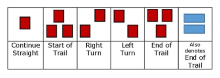
- Be aware of your surroundings and check out options. There might be a trail that takes you around a steep area, consult your map.
- Remember to check the State Parks Twitter to confirm the park is open and plan your trip accordingly. With the Passport to Parks Program, Connecticut residents are no longer required to pay a parking fee at CT State Parks and Forest recreation areas, due to DMV collecting a $10 fee ($5 per year) on behalf of DEEP at the time of registration and registration renewals for non-commercial motor vehicles.
- Stay clear of active forest management. Roads and trails may be temporarily closed to accommodate tree thinning activities.
- UCONN and CT Trails provides useful trail safety and etiquette guidelines for trail users at the following: Trail Safety and Etiquette Guidelines for Trail Users
- On the trail, courtesy is a necessity: if you ride a bike, you must yield to everyone; if you are hiking or walking around, you must yield to horses; if you ride a horse, you have priority but should observe caution because not all trail users will be aware of this. If you are unsure of how to approach a horse on a trail, these guidelines can help.
Please be aware that the number of miles included in the write-ups above are suggested for participants to hike or walk. Participants can shorten or lengthen the hike or walk they take at their discretion.
Sky’s the Limit 2023 Participant Photos and Hiking Stick Winners

