Pachaug State Forest
Voluntown, CT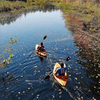
Main (860) 376-4075
Overview
KNOW BEFORE YOU GO
- An alcohol ban is in place at Pachaug State Forest
- Buses seating more than 30 passengers are not allowed
- Gated roads within the forest are typically closed from January 1st through March 31st annually, but closures may occur earlier if severe weather occurs
- Trail Map - Green Falls
- Trail Map - Mt. Misery
ATV/Off Roading
Enduro Trail
Pachaug State Forest offers a 58-mile enduro motorcycle trail for registered street legal motorcycles. This trail is marked by a white diamond with a red arrow and begins at the Enduro parking lot on Spaulding Road in Plainfield, CT.
Biking
The dirt and gravel multi-use trails that zigzag through the forest are popular with mountain bikers. And in winter when snow blankets the forest, the unplowed gravel roads and vast network of trails become a wonderland for snowmobilers, cross-country skiers, and snowshoers.
KNOW BEFORE YOU GO
- Trail Maps: Chapman Area | Green Falls Area | Snowmobile
- Mountain Biking Stats and Ride Reports: Quiet Corner NEMBA | Trailforks
Boating
KNOW BEFORE YOU GO
Boat Launches
- Green Fall Pond Car-Top Boat Launch: At Route 138, take access road south to the Green Falls area of the Forest. Follow signs to launch.
- Beachdale Pond Trailered Boat Launch: The launch is located on the east side of Route 49, one mile north of the Route 138 and Route 165 junction.
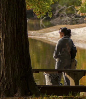
Whether you want to leisurely paddle around the small islands of Green Fall Pond (also known as Green Fall Reservoir) or zip around Beachdale Pond in a motorboat, you choose your speed at Pachaug. (As long as you keep it below 8 MPH, please).
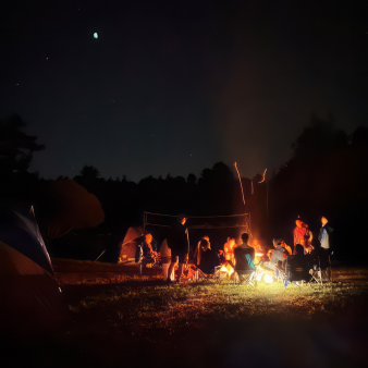
Camping
Pachaug State Forest Campgrounds
KNOW BEFORE YOU GO
- No alcohol
- Campground is located near public lands open to hunting. Please use caution.
- Camping in Connecticut State Parks and Forests
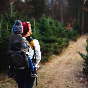
Pachaug’s seemingly endless trails, streams, and forest to explore make it a perfect spot to set up camp and stay awhile. And with eight different camping options, you can find what you’re looking for, no matter your camping style. Plus, the forest is one of the few pet-friendly spots in the state, so your best friend can join you for the adventure. Even horses are welcome. Youth group camping is also available to qualifying youth organizations.
The forest has two main campgrounds. Mount Misery Campground, located in the Chapman area of the forest, is nearby its namesake and the forest’s highest peak and in striking distance to the stunning Rhododendron Sanctuary. Green Falls is the — surprise, surprise — Green Falls area and has convenient waterside access to swimming and fishing at Green Fall Pond.
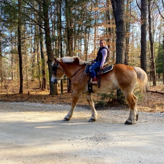
A third campground dedicated to the equine set is located near the intersection of two horseback riding trails, near Mount Misery Brook.
All three campgrounds are somewhat rustic without showers, RV hookups, and other creature comforts. But what they lack in frills and cell phone signal, they more than make up for with natural scenery, fresh air, and solitude. The perfect place to get away from it all!
2026 Season: Opens Friday, April 10 and closes Monday, October 12 at noon
Forest office: (860) 376-4075
Green Falls Campground
- Green Falls Road (Green Falls area)
- 18 wooded campsites with picnic tables
- Two pets allowed per campsite
- Daily Rate: $17 resident/$27 non-resident plus processing fee
- Six-person maximum per site
- Maximum stay: 14 days
- Campground Map
Mount Misery Campground
- Off Route 49 (Chapman area)
- 22 wooded sites with picnic tables
- Two pets allowed per campsite
- Daily Rate: $17 resident/$27 non-resident plus processing fee
- Six-person maximum per site
- Maximum stay: 14 days
- Campground Map
Frog Hollow Equestrian Campground
- 41.606° N, 71.866° W
- 2025 season: April 11 – October 13 at noon
- 18 semi-wooded equestrian campsites (available exclusively to equestrians with their horses - no horse rentals available)
- Available first-come, first-served
- Daily Rate: $17/residents $27 non-residents, payable on site.
AMENITIES
- Compost toilets
- Recycling
- Two pets/site permitted
RESERVE A CAMPSITE
- Online: Green Falls Campground | Mount Misery Campground
- By phone: 1-877-668-CAMP (2267)
- Equestrian Campground are sites available first-come, first-served.
Youth Group Camping
- 2 sites available, each site accommodates up to 100 campers OR if both sites are reserved together, accommodates up to 300 campers
- Open to qualified youth groups only
- Advance reservations are required
- Youth Group Camping
Pachaug State Forest Trail Backpacking Campsites
KNOW BEFORE YOU GO
- Two pets allowed per campsite.
- Camp only in designated areas indicated on the map and by signs.
- Backpacking areas are located near public lands open to hunting. Please use caution.
- Backpacking in Connecticut State Parks and Forests
Itching to explore a little deeper into the forest? Reserve a permit to camp at one of the forest’s four backpacking sites and some of the few scattered throughout the state.The backpack camping areas are primitive sites with few facilities. Although several have Adirondack-type lean-tos of limited capacity, we recommend bringing your own tents. Also, drinking water is not provided except at approved state park and forest wells.
Dawley Pond Lean-To
- 41.621° N, 71.815° W
- Backpacking site with primitive lean-to shelter, a fire ring, and nearby pond for drinking water
- Location: Pachaug Trail, west side of Great Meadow Brook Pond
- Availability: Year-round with permit
- Maximum stay: One night
Dry Reservoir Lean-To
- 41.591° N, 71.881° W
- Backpacking site with primitive lean-to shelter, fire pit, and nearby stream
- Location: Near the intersection of the Nehantic and Pachaug Trails
- Availability: Year-round with permit
- Maximum stay: One night
Legend Wood Lean-To
- 41.497° N, 71.876° W
- Backpacking site with primitive lean-to shelter, a fire ring, scenic views, and a nearby pond for drinking water
- Location: Narragansett Trail, north of Wyassup Lake
- Availability: Year-round with permit
- Maximum stay: One night
Peg Mill Lean-To
- 41.533° N, 71.802° W
- Backpacking site with limited camp shelters, a fire ring, and nearby stream
- Location: Narragansett Trail, east of Green Fall Reservoir near the Rhode Island border
- Availability: Year-round with permit
- Maximum stay: One night
CAMPING PERMITS
- Backpack camping permits are available by reservation only. To get a permit, call (860) 295-2923.
- Submit your application form at least two weeks before your intended stay.
- Download Backpacking Application here.
Fishing
KNOW BEFORE YOU GO
Before heading out, be sure to check the latest water conditions and fishing regulations.
Hiking
KNOW BEFORE YOU GO
- Trail Maps: Chapman Area | Green Falls Area | Snowmobile
- Blue-Blazed Hiking Trails Interactive Map (Blue-blazed trails are foot traffic only)
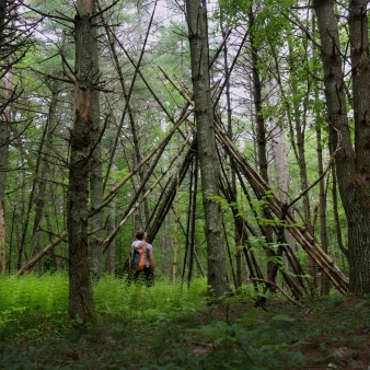
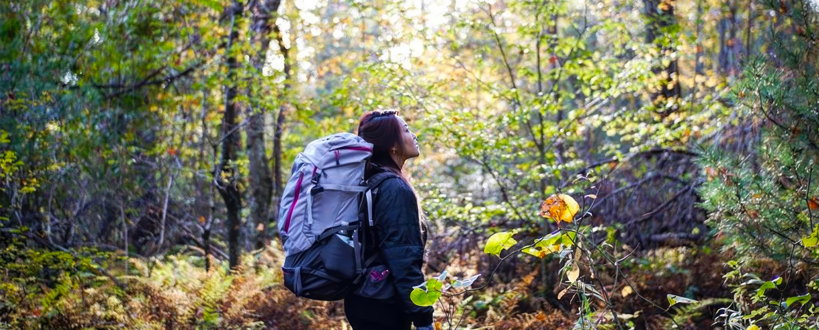
With four blue-blazed trails that traverse the wilds of the Eastern Connecticut, popular routes to scenic overlooks like Mount Misery, loops that bring you closer to the forest’s ponds, a well-established backpacking trail network, and with a number of multi-access trails, Pachaug is a hotspot for every type of trail user.
Of the blue-blazed, foot-only trails, sections of the Nehantic, Pachaug, and Quinnebaug trails pass through the Chapman area. And Green Falls, Narragansett, Nehantic, and Pachaug through the Green Falls area.
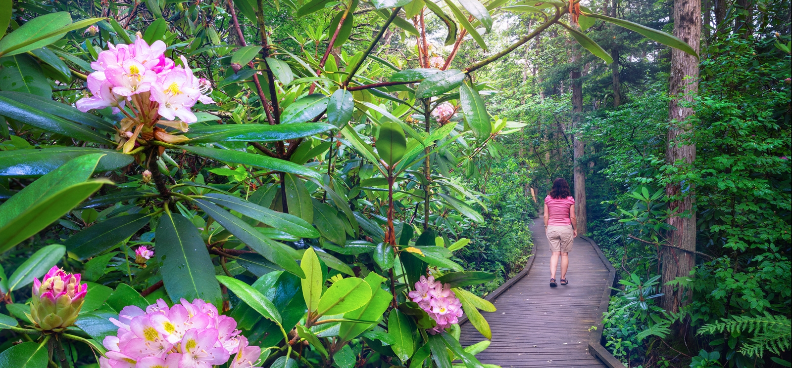
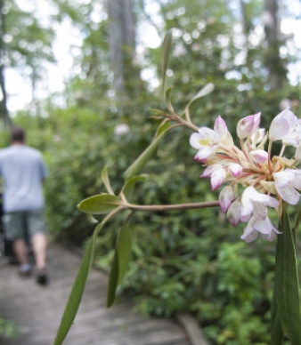
Rhododendron Sanctuary Trail
- Nature walk
- Level of difficulty: Easy
- A short scenic walk (including a planked wooden boardwalk) through rare ecological terrain — one of only few such areas in New England. The walk beautiful all year long, but especially spectacular when the rhododendron are in bloom, usually around July 4th.
Green Fall Pond Loop
- 1.8-mile loop around the pond
- Level of difficulty: Moderate
- Take a walk around Green Fall Pond for some picturesque water — and waterfall — views, solitude, and to get your blood pumping. Cooling off in the pond afterwards is optional but recommended! (In the summer, at least.) The trail is rocky and steep in parts, but well-maintained and well-marked.
Mt. Misery Trail (Blue Blaze)
- 1.9-mile loop with scenic overlook
- Level of difficulty: Moderate
- This trail requires a bit of a climb (though not as treacherous as the name would have you believe) but rewards you with some of the best scenic views in eastern Connecticut, which gives you some of the best scenic views the area has to offer. At 441 feet, Mount Misery Overlook is the highest point in the area and offers panoramic views of the forest and surrounding towns for its rock outcropping at the summit.
Interested in Letterboxing? Get clues for the High Ledge Lookout.
Hunting
KNOW BEFORE YOU GO
Consult DEEP for more information on the latest rules and restrictions by season.
Many areas across the forest are open to public hunting and trapping, with both firearms and archery permitted. Depending on the season, hunting is permitted for:
- Small game
- Waterfowl
- Fall deer/turkey
- Spring and fall firearms turkey
- Muzzleloader deer
- No-lottery shotgun deer
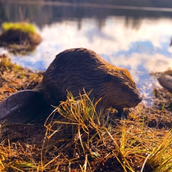
Nature
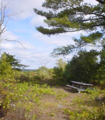
Picnicking
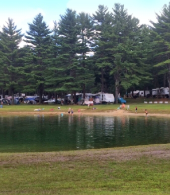
Swimming
KNOW BEFORE YOU GO
Swimming is allowed in the Greenfalls Pond section of Pachaug State Forest.
- Current Water Quality Report (updated weekly, Memorial Day – Labor Day)
- Beach Regulations and Swimming Safety Information
Winter
Additional Park Info
Free
Fees apply for camping
N/A
Yes, on leash